-
If you enjoy the forum please consider supporting it by signing up for a NES Membership The benefits pay for the membership many times over.
You are using an out of date browser. It may not display this or other websites correctly.
You should upgrade or use an alternative browser.
You should upgrade or use an alternative browser.
Building/cutting out a 200yd Holler-Top Shooting Range! I need expertise from engineers, woodsmen and short to mid range shooters.
- Thread starter 76Too
- Start date
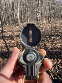
Alternate which way you go around trees. You'd be surprised.View attachment 706680
Going to try it ‘old school’ first.
![Laugh [laugh] [laugh]](/xen/styles/default/xenforo/smilies.vb/012.gif)
Land nav was never my strongest skill set.Alternate which way you go around trees. You'd be surprised.![Laugh [laugh] [laugh]](/xen/styles/default/xenforo/smilies.vb/012.gif)
I’ve got a rough idea of where it’s going and the trees marked accordingly. I’m wanting to tweak it a tiny bit on each end (firing line and impact area) and I’m running into my limit of being able to do the math.
Mesatchornug
NES Member
Sounds like an excuse for another gun
Amazon product ASIN B08N5V9JHFView: https://www.amazon.com/Empire-Mini-Paintball-Piece-Barrel/dp/B08N5V9JHF
Amazon product ASIN B08N5V9JHFView: https://www.amazon.com/Empire-Mini-Paintball-Piece-Barrel/dp/B08N5V9JHF
TG Pioneer
NES Member
Use the bezel ring like you’re doing night land nav. Keeps your azimuth a bit better.Land nav was never my strongest skill set.
I’ve got a rough idea of where it’s going and the trees marked accordingly. I’m wanting to tweak it a tiny bit on each end (firing line and impact area) and I’m running into my limit of being able to do the math.
I think I have a rough idea at least. It took me all afternoon and walking back and forth about 20 times, but my dog still enjoyed the time in the woods.
I marked probably 20-30 trees w/caution tape and have a definite spot for a firing line.
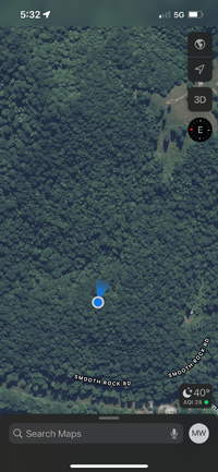
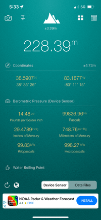
I just need to work out my preferred spot for a backstop and then will start cutting the lane.
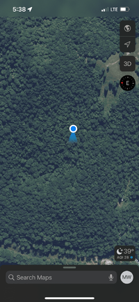
The locations pictured are my firing line and my potential backstop area. They’re relatively ‘flat’ but there’s a big drop in between them where the log road comes up from my back yard. The road needs to be cleared and groomed as well.
I marked probably 20-30 trees w/caution tape and have a definite spot for a firing line.


I just need to work out my preferred spot for a backstop and then will start cutting the lane.


The locations pictured are my firing line and my potential backstop area. They’re relatively ‘flat’ but there’s a big drop in between them where the log road comes up from my back yard. The road needs to be cleared and groomed as well.
Last edited:
What app are you using?I think I have a rough idea at least. It took me all afternoon and walking back and forth about 20 times, but my dog still enjoyed the time in the woods.
I marked probably 20-30 trees w/caution tape and have a definite spot for a firing line.
View attachment 706846View attachment 706847
I just need to work out my preferred spot for a backstop and then will start cutting the lane.
View attachment 706856
View attachment 706849
The locations pictured are my firing line and my potential backstop area. They’re relatively ‘flat’ but there’s a big drop in between them where the log road comes up from my back yard. The road needs to be cleared and groomed as well.
If you order a GARMIN hand held (like the 65 or 66 - I forget the exact number) you can mark waypoints as you are walking and use it to measure areas. It will help you stay straight and it has topo maps.
I should have thought of this earlier.
Then you can return it to Amazon.
I should have thought of this earlier.
Then you can return it to Amazon.
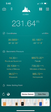
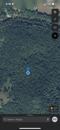
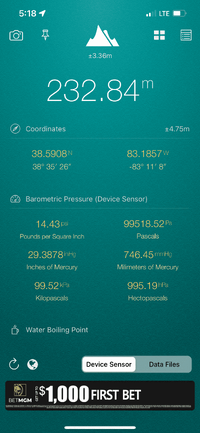
I used a free app called ‘My Altitude’ just to validate my ‘feelings’ that the firing line and impact area were relatively ‘flat’ to each other. They are…or at least very close and almost could be considered exact within the margin of error listed.What app are you using?
Other than that, just a lensatic compass, a piece of string, and some caution tape to mark the trees that will have to come down if I end up using that lane. To be honest though, I think I might change it a little before I start cutting because I’d like the impact area to be a little tiny bit farther to the north, so if I decide to cut to 300yds I’ll be able to do so within the same lane (though I won’t be shooting near as ‘flat’ at that point because the mountain grade increases pretty substantially after the 200yds mark.)
If I went out to 300yds, I would probably have to dig my impact area by hand because I’m not sure I’d want to drag my tractor all the way up there. The way UP wouldn’t be as scary as the way DOWN however. It’s pretty steep over there. Hank and I hike it at least twice a week and I usually eat shit (fall) at least once on the way down.
And @Mesatchornug has been giving me some pointers on the ‘OnX’ app that I’ll be getting soon so I can ‘map’ my whole property and all the trails. I’m waiting until the end of the month to get it because I overdid it on Christmas and cow expenses last month and need to recoup, but it should do the same or similar as any Garmin.What app are you using?
I just Googled that ONX app. Looks pretty nice.And @Mesatchornug has been giving me some pointers on the ‘OnX’ app that I’ll be getting soon so I can ‘map’ my whole property and all the trails. I’m waiting until the end of the month to get it because I overdid it on Christmas and cow expenses last month and need to recoup, but it should do the same or similar as any Garmin.
Ok, I moved my impact area to the north by about 50’…this will allow me to shot to 300yds eventually while still having plenty of room for error in both directions in case of a pulled shot (rarely happens, but part of the reason I even want a 300yd range is to practice offhand with my M1A match for if I ever make it to camp perry.)
The impact area for 300yds WILL be elevated from the firing line by approximately 50-60ft, but I’m thinking that might still be worth while. I’ll cross that bridge when I come to it.
For the time being, moving the 200yd range lane was still a good idea because it puts the impact area in a ditch on the west side of the mountain. There will be WAY less chance of a ricochet than with the previous lane.
Another benefit is that the (yet to be cleared) access road will now be free of any danger while anyone is shooting. The elevation of the firing line and impact area are well over 50’ higher than the road.
I picked a pretty good lane and marked all the necessary trees. I have 4 medium/large trees to fell (I think all of them are beech) and all the rest are small (10” or less diameter).
I have to sharpen all my chains before I start cutting, but I think it will go pretty quick once the ball is rolling.
This is the new impact area location for 200yd range. Photo shows me pointing in the direction of the firing line. I will not be shooting in this direction…there are about 50 houses right over the creek.


Share:
Similar threads
- Replies
- 0
- Views
- 151
